
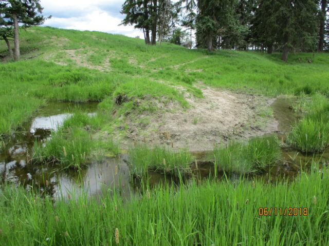
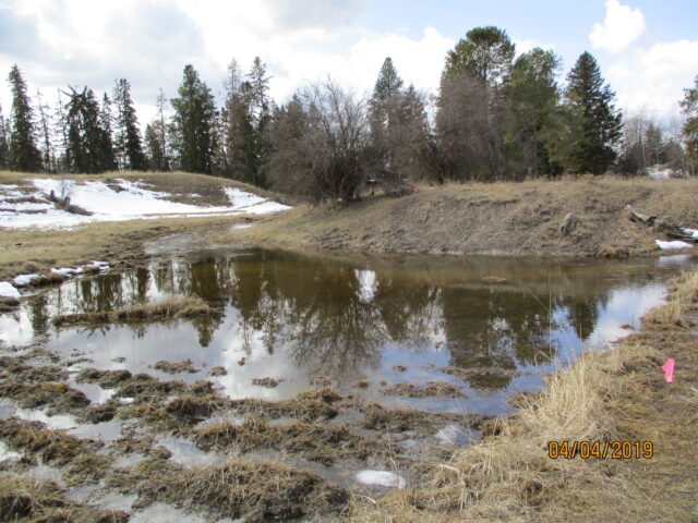
Trumbull Creek Restoration and Aquifer Protection Project
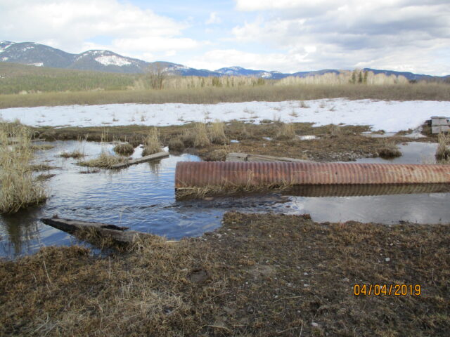
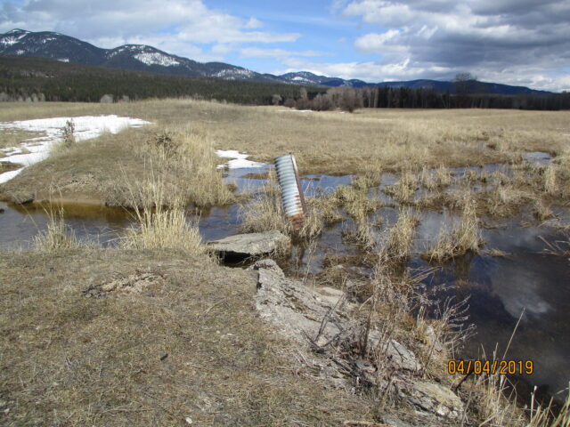
Trumbull Creek is a small tributary to Whitefish River and is approximately six miles southwest of Columbia Falls. The stream has been significantly altered in the past, is intermittent in some locations, and causes minor flooding during periods of high groundwater and runoff. Trumbull Creek also flows beneath Glacier Park International Airport (GPIA) and causes impounding of water, which creates safety concerns for bird strikes by aircraft and possible groundwater quality contamination.
In 2019, we received a Renewable Resource Grant from Department of Natural Resources and Conservation (DNRC) to assist with project implementation. The project will largely consist of regrading portions of the stream channel, removing a historic earthen dam, and replacing undersized or improperly placed culverts. The goals and purpose of the project are to:
- Restore hydraulic function to the creek
- Reduce flooding on private property and at the airport
Groundwater monitoring, site surveying, and data collection will take place in early spring, 2021. The data will be used to inform the hydraulic modeling and final, engineered designs. We hope to have construction underway during low water in Fall, 2021.
Stay tuned for updates as this project takes shape!
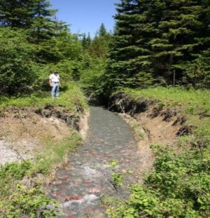
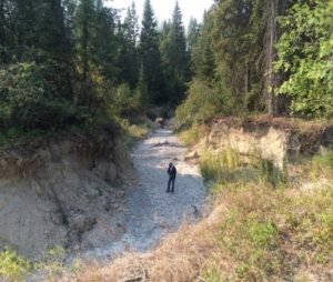
Cow Creek Restoration Project
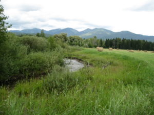
Cow Creek is a small, yet important, stream that flows east of Whitefish and enters the Whitefish River just south of downtown. Historic and current land use practices along Cow Creek have lead to bank instability and erosion, channel widening and entrenchment, disconnection from the floodplain, upland soil compaction, and alteration stream-side vegetation. These issues have lead to excessive sedimentation, nutrient loading, and high in-stream temperatures which can further impair downstream waterbodies including Whitefish River, Flathead River, and Flathead Lake.
The overall goal of the Cow Creek Restoration Project is to improve water quality and ecological integrity in Cow Creek. As a tributary of the Whitefish River, this project will help to prevent future impairments downstream and restore hydrologic function and riparian vegetation.
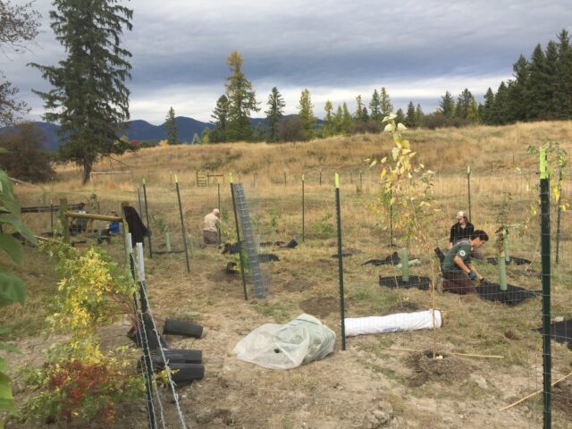
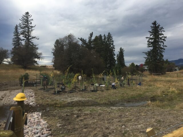
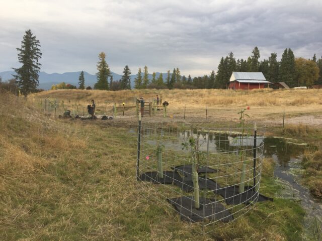
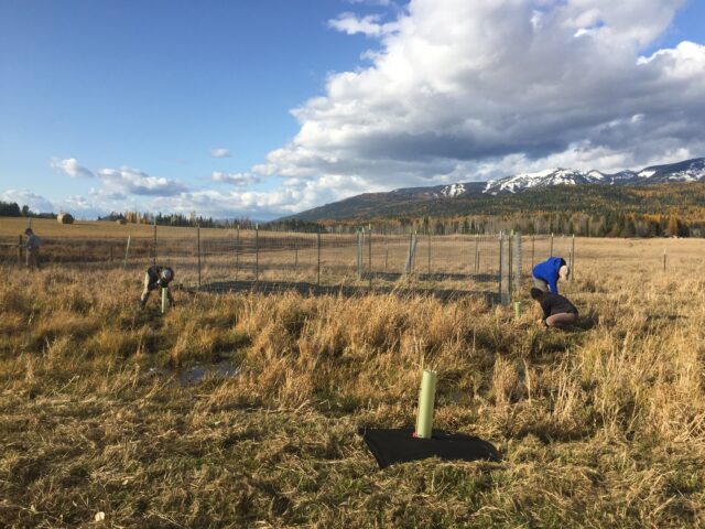
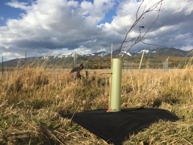
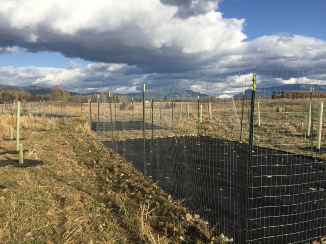
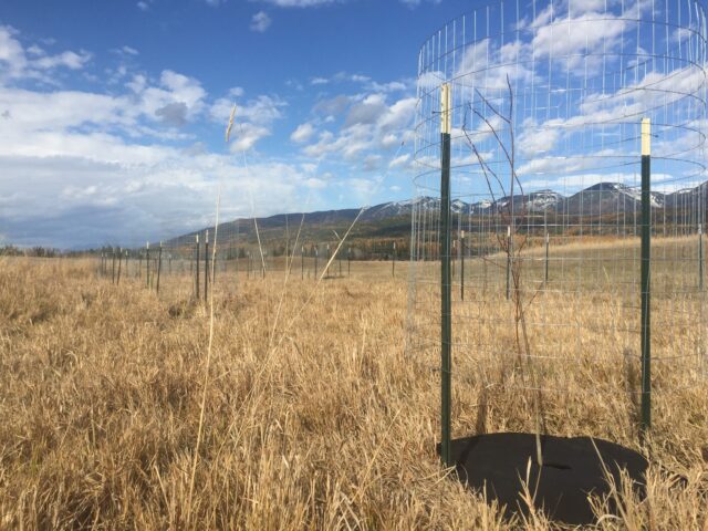
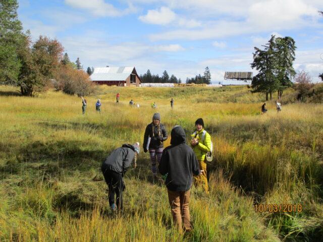
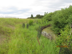
To accomplish this objective, project partners have worked with two landowners to install hardened crossings and exclosure fences which will prevent damage from livestock grazing. Over 1,300 native plants are also being planted to restore the riparian area which will provide bank stabilization, reduce erosion, and help to reconnect the stream to the historic floodplain.
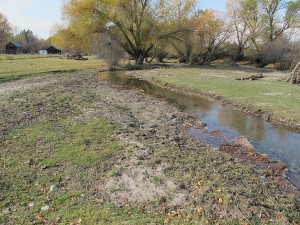
Prior to construction Cow Creek suffered from overgrazing, channel widening, loss of native vegetation, and excess nutrients. The pictures below demonstrate some of the damage and issues.
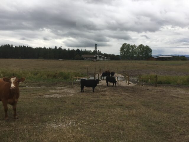
A hardened crossing and livestock exclosure fence were constructed at each site. The fencing will keep livestock out of the creek except at the hardened crossing where they can access the water for drinking and cross the creek without damaging it. Fencing the livestock out of the creek will prevent further damage to the vegetation and stream banks and keep excess nutrients from livestock manure farther away from the stream.
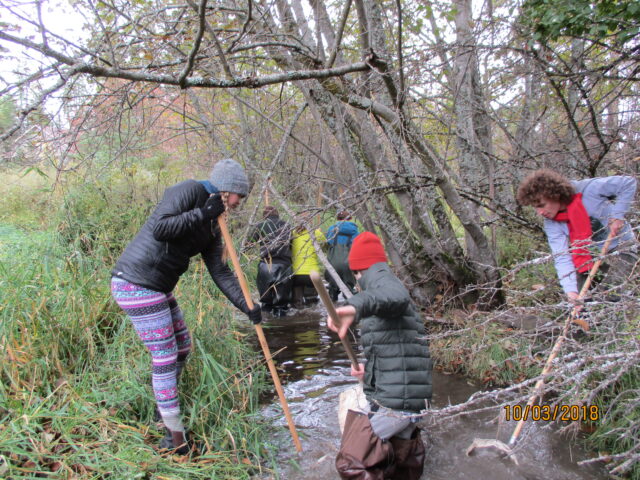
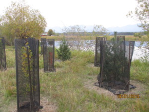
Once the fencing and hardened crossings were complete, project partners, MCC crews, and volunteers worked to restore the native vegetation. A variety of native, riparian species were planted including aspen, willow, cottonwood, alder, hawthorn, serviceberry, woods rose, and sedges. To ensure the best survival rate, temporary enclosures were built around all the plants, either individually or in groups, to keep the deer off. Weed matting was installed around each plant to reduce root competition from grasses and weeds. Many of the species were also protected from voles using tubes around the base of the plant.
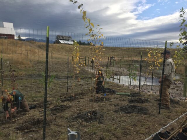
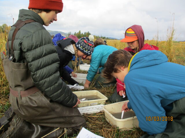
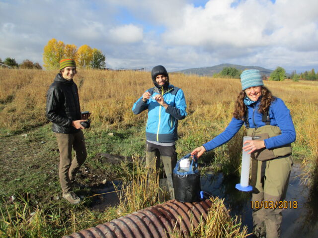
To help monitor the effectiveness of the restoration project, we are also conducting water quality sampling and monitoring the vegetation with assistance from the FREEFLOW club students at Whitefish High School FREEFLOW.
Restoration Projects are an important part of Flathead Conservation District’s work to protect natural resources in the Flathead Valley. We work with private and public partners and landowners to remove invasive weeds and help establish native plants to improve the quality and function of local habitats. We also provide technical and financial support for stream restoration projects, such as replacing undersized or failing bridges and culverts and stream bank restoration and stabilization efforts.
In 2016, FCD hosted a member of the Montana Big Sky Watershed Corps (part of Montana Conservation Corps) to develop a watershed restoration plan (WRP) for the Flathead-Stillwater region. The WRP provides a framework for managing, protecting, and restoring water resources. It also fulfills one of EPA’s requirements for receiving grant funding for projects that reduce nonpoint source pollution (Section 319). Access to 319 funding enables FCD and stakeholder groups to pursue a broad range of restoration projects, and a WRP allows FCD to establish priorities and strategies for long-term planning in the county. Our WRP has been submitted to Montana DEQ and is awaiting approval.
Flathead River Steward Program
FCD is also a partner in the Flathead River Steward Program. This collaborative effort helps landowners improve and restore riparian forests along our rivers to improve water quality, recreational opportunities, abundant fish and wildlife, and productive farm soils in the Flathead Watershed. This program is the riparian and wetlands restoration working group of the Flathead River to Lake Initiative. The partnership recently released a new video about the program that aims to help people improve lands along rivers and streams. Meet a landowner and the partners working with landowners to improve stewardship of lands along our rivers!
For more information about the Flathead River Steward Program contact: Franz Ingelfinger, Restoration Ecologist, Montana Fish, Wildlife & Parks, (406) 751-4580
Flathead Conservation District’s On-the-ground Projects
Haskill Creek Reimer Reach Floodplain Renovation (Haskill Basin Watershed, NE of Whitefish, 2012)
A floodplain renovation project addressed steep, eroding banks along a 1,222-ft stretch. Banks were lowered to floodplain elevation, stabilized with woody debris jams, and revegetated with woody shrubs and native grass seeding. Students from Whitefish High School’s Project FREEFLOW program provided volunteer labor and project monitoring, which facilitated service-learning opportunities and community building. Funds were provided from the Montana DEQ Nonpoint Source Pollution 319 program, FCD and the contractor. Detailed information can be found in the project final report.
Voermans/Klungness Restoration (Haskill Basin Watershed, 2005, 2007)
 This project restored approximately 1,200 feet along the creek by re-establishing hydrologic connectivity between the active channel and the floodplain. The banks were stabilized using vegetated soil lifts, large woody debris jams, and dormant willow cuttings; also, woody shrubs were planted on the floodplain terraces. The restoration work decreased the erosion potential in the area from extreme and very high to high and moderate, and it resulted in an 86% reduction in sediment going into Haskill Creek. Funding was provided by the Montana Fish, Wildlife & Parks Future Fisheries Improvement Program (2005), the Montana Department of Environmental Quality 319 program (2007), and FCD.
Haskill Creek Flow Monitoring (2014).
A flow monitoring gaging station was installed on Haskill Creek at the Monegan Road crossing. FCD and the City of Whitefish each contributed half of the station installation costs, and the Whitefish Lake Institute secured the contract for gage installation and calibration. The data will allow the partners to monitor creek flow rates, and, ultimately, estimate nutrient loadings. Flow monitoring information from 2014 is available here.
Currently, FCD is working with the Haskill Basin Watershed Council to replace an undersized, perched culvert on Haskill Basin Road with funds from DNRC’s HB223 grant program.
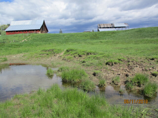
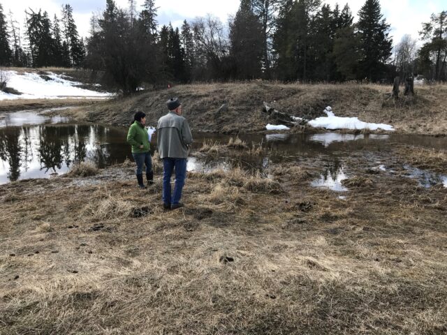
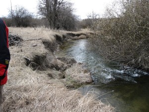
Trumbull Creek (SW of Columbia Falls, 2015)
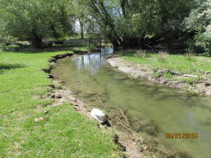
Willow encroachment and minimal grazing management on a 4,000-foot stretch of Trumbull Creek had been contributing to bank instability, which was intensifying local flooding. FCD procured funding to mitigate flooding on the Upper Reach by increasing bank heights, restoring the existing levees, and managing livestock grazing with fencing and a water gap. This successfully alleviated flooding on adjacent private property by removing debris, re-establishing channel depth, and restoring the integrity of existing levees. The grant also funded a technical assessment on the Lower Reach to conduct a hydraulic analysis of a problematic culvert system in a creek crossing. This project accomplished significant remediation on the Upper Reach of Trumbull Creek, which directly affected nine landowners. Learn more about this project.
Krause Creek (NW of Bigfork)
Historically, Krause Creek did not support a single channel between its upper watershed in the Swan Mountains and its terminus at Echo Lake. Instead, upon reaching the valley floor, it spread into a series of distributary channels across an alluvial fan. As is typical of land development on alluvial fans, ongoing excavation and channelization has been done in an attempt to reduce flooding and concentrate flow into a primary channel. These efforts have resulted in significant downcutting and erosion in the lower watershed, resulting in substantial sediment inputs to Echo Lake. FCD completed a watershed planning assessment in 2016 with grant money from DNRC’s Renewable Resource Grant and Loan (RRGL) Program. A construction grant was submitted to DNRC’s RRGL program in 2016 for $116,000. The proposed project would stabilize the channel, effectively reducing flooding to nearby residences and sedimentation to Echo Lake. Funding will be determined during the 2017 legislative session.
Learn more about our Landowner Assistance Program that provides landowners with cost-share assistance to support implementation of conservation practices on private property.
Learn about our Flathead-Stillwater Watershed Restoration Planning process.