By Jessie Walthers, Conservation Program Manager Groundhog Day. Who doesn’t love this most random of…
Where’s all the snow and where will it go?
By: Fiona Handler, Big Sky Watershed Corps Member
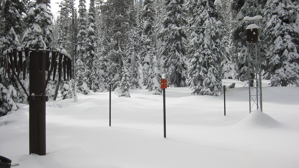
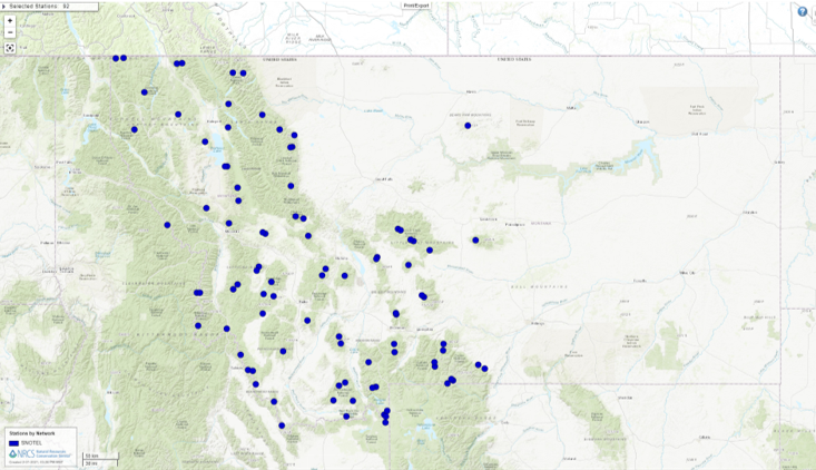
Some of you may have noticed that this winter has not brought a ton of snow…YET! If you are interested in keeping track throughout the season, the Montana Snow Survey from the Natural Resources Conservation Service (NRCS) is a great resource. NRCS uses a network of sensors installed in high country locations across the western U.S. called SNOTEL, or Snow Telemetry. This technology collects data on snowfall as “snow water equivalent”, which is a measure that considers how snow compresses and becomes dense after falling. This is different than other simpler forms of data which just record total inches of snow fallen. From this, NRCS considers climate data and creates a monthly Water Supply Outlook Report (WSOR) that is available on the fifth business day of every month. This report has lots of important information that helps individuals, organizations, and government agencies. SNOTEL data are transmitted by satellite from locations across the state and updated hourly into the public portal.
Snow pack influences water availability, and water availability influences the environment and local economies year-round. For example, outdoor recreation generates billions of dollars every year and provides jobs for over 70,000 people in Montana. Those who work in the outdoor recreation field can use the WSOR to find out crucial information about current conditions and forecasts. For a ski resort, knowing the amount of snowpack is obvious and can direct decisions on snow making and expectations for visitation. For a river guide, the amount of snowpack from winter will tell them how high the river flow will be when the snow melts, how long the boating and angling season could last, or what kind of conditions to prepare for. Agencies rely on snowpack data for flood and drought forecasting. These data are also imperative for the agriculture industry, so they know what to expect for the irrigation season as temperatures and evaporation rates increase in spring and summer.
So far this winter, snow fall has been below normal, but that does not necessarily mean it will not come later in the season. To see the data for Flathead County follow this link. You can also sign up to receive emails with snowpack updates and water supply forecasts on the NRCS Montana Snow Survey website.
For more information about the work being done by the NRCS Snow Survey check out this YouTube video!
This Post Has One Comment
Comments are closed.
Related Posts
Awesome post. I am a normal visitor of your web site and appreciate you taking the time to maintain the excellent site. I will be a frequent visitor for a really long time. Meriel Brew Annnora